
New technology developed by NEC Corporation will provide more accurate measuring of sea levels from greater distances using 3D Light Detection And Ranging (LiDAR).
Current radio wave and float-type sea level measurement systems have a measurement range of about 20 metres from the sea’s surface. In the event of a tsunami caused by an earthquake, volcanic eruption, or other phenomenon, immediate and accurate assessment of changes in sea levels is critical to saving lives. In June 2024, NEC conducted a successful demonstration test of this technology, confirming that it can accurately measure sea levels from a greater distance than conventional technologies.
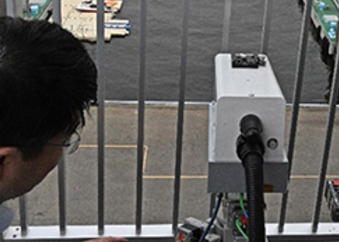
NEC’s new technology delivers 3D-LiDAR infrared laser beams to buoys floating on the sea and reflected light is used to measure the distance. This ultra-sensitive optical reception works by using long-range 3DLiDAR with advanced long-range, large-capacity optical transmission and reception technology (coherent reception technology), making it possible to obtain the 3D point cloud data of objects from greater distances. As a result, this is the first time that sea levels have been successfully measured from a distance of 60 metres from the sea with an error of about two centimetres.
In addition, NEC has developed 3D water level measurement technology that clusters processing of the acquired 3D point cloud data, classifies the shape of buoys and surrounding topography with high precision, and then compares the information to correct the position and estimate the height of buoys. This makes it possible to measure from various locations and angles, meaning that 3D-LiDAR equipment can be installed in a wider variety of locations.
As a result, tide stations may be installed in locations along the coastline that are less susceptible to significant ground movement, making the system disaster-resistant and enabling continuous monitoring of sea levels. In addition, the equipment is portable and may be flexibly installed across a wide range of locations, helping to reduce installation costs and time.
NEC plans to continue developing this technology, including extending the measurable distance to several hundred meters and improving measurement accuracy by comparing 3D-LiDAR data with map information of the surrounding area. The company aims to have the technology available by early 2026.


