
Advanced Navigation has unveiled a new 3D Laser Velocity Sensor (LVS) designed to address one of underground mining’s most persistent challenges: maintaining accurate vehicle positioning in deep, dark and constantly changing environments where GPS signals are unavailable.
In underground operations, vehicle localisation is critical to productivity and safety. Once a vehicle enters a portal or adit, satellite navigation ceases to function. To compensate, many mines deploy fixed infrastructure such as Wi-Fi beacons, radio tags or reflective markers. These systems require continuous maintenance as the mine face advances, adding cost and operational complexity — particularly in development zones that are extended or reconfigured frequently.
Joe Vandecar, Head of Product at Advanced Navigation, says navigation failures can trigger cascading operational impacts.
“In a production environment, navigation is critical. When positioning fails, haulage stalls, drill rig alignment drifts, and ore reconciliation becomes inaccurate. These disruptions create a cascade of operational lag that directly erodes profitability,” he said.
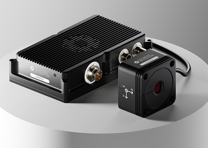
The company’s new system, branded Chimera Land, is designed as an onboard, infrastructure-light alternative. When fused with an Advanced Navigation inertial navigation system (INS), the 3D Laser Velocity Sensor measures a vehicle’s ground-relative velocity in three dimensions using specialised lasers. Rather than querying an external beacon or satellite, the system continuously feeds velocity data into the INS to reduce drift — the gradual positional error that accumulates in standalone inertial systems over time.
The integration is managed through the company’s proprietary AdNav Intelligence software, which uses adaptive algorithms to dynamically weight sensor inputs in real time. Depending on environmental conditions and sensor reliability scores, the system adjusts how much influence each data stream has on the final position estimate.
The result, according to the company, is a resilient positioning capability suited to high-dust, zero-light and high-vibration environments typical of underground mining.
Chimera Land was recently demonstrated in what is described as Europe’s deepest underground mine, a 1.4-kilometre-deep network of tunnels, as part of BHP’s Deep Mining Call initiative. Integrated with the Boreas D90 INS, the system achieved a final position error of 15.9 metres over a 22.9-kilometre transit — equivalent to an error rate of approximately 0.07 per cent of distance travelled.
Advanced Navigation reports that the system consistently delivered better than 0.1 per cent positional accuracy across five separate test runs, without relying on fixed positioning infrastructure, pre-existing maps or external aiding signals.
In practical terms, the ability to sustain sub-decimetre velocity accuracy over long underground traverses has implications across multiple mining workflows. Autonomous haulage systems operating in development areas could continue high-speed tramming without pre-surveyed beacons. Drill rigs and robotic scaling equipment would benefit from improved alignment precision. Fleet managers could maintain real-time asset tracking and ore reconciliation even in so-called “dead zones” where communications networks are limited.
High-fidelity 3D velocity data may also enhance predictive collision avoidance systems by improving time-to-collision calculations and reducing nuisance alarms — a frequent challenge in confined underground spaces.
As mines extend deeper and into more geologically complex regions, the economics of installing and maintaining fixed positioning infrastructure become increasingly challenging. An infrastructure-light approach could support faster development cycles while reducing exposure of personnel to hazardous zones.
Vandecar argues that positioning certainty underpins broader autonomy ambitions.
“To keep human operators safe from hazardous conditions, assets must possess the ‘situational intelligence’ to make real-time decisions,” he said. “Chimera Land provides the foundational certainty required for this evolution, ensuring absolute positioning integrity in the world’s most challenging environments.”
For the smart infrastructure and autonomous mobility sector, the development highlights how navigation technologies originally driven by defence and aerospace applications are increasingly being adapted to industrial and resource environments where reliability, resilience and independence from external signals are becoming essential.


